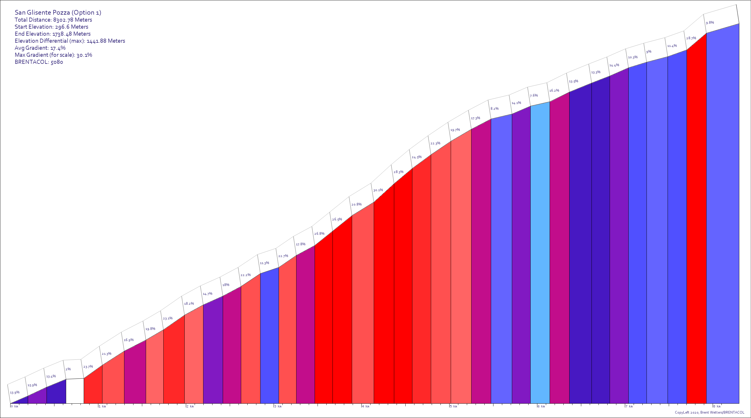
San Glisente Pozza is located in Italy. It is 8302.8 meters long with an average gradient of 17.4% and a maximum gradient of 30.1%. Find similar hills.
View this hill in the BRENTACOL Toolkit!This hill is one of many claimants to the hardest/steepest paved road in the world. I typically try to avoid such judgments because they rely on improper comparisons (i.e. the difference between average gradient and maximum gradient, and maximum gradient threshold--30% for how long? 10 meters or 50 meters makes a huge difference) or compare hills of completely different lengths. But any way you slice it, this is a nasty, nasty hill. In this case, the "paved" part of the designation is also debatable. It would appear that some sort of "paving" technology is used the whole way up, but some of it looks like narrow strips of asphalt in a 2-track formation with dirt/grass in the middle. This would make this hill even harder than its gradient suggests, since it would make "snowplowing" impossible. Other parts look to be large rough cobblestone.
I have known about this climb for a while now. It surfaced a few years back as an alternative to the famously difficult Scanuppia. Unfortunately, I couldn't find a reliable track to follow to make the map. (Climb-by-bike just shows the start and finish, but not the track. I finally found a road up to the "Chiesa San Glisente" in ridewithgps, which produced a rather ridiculous profile with a brentacol score of >7000, making it easily the "hardest" hill in the database. I was, however, able to find a strava segment (see below) that has a different destination and a somewhat different track. Since Strava and Ridewithgps use different basemaps, finding the exact track wasn't easy, and the resulting track is almost a kilometer shorter, but that may just have to do with noise in the strava track.