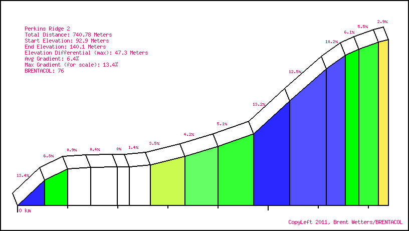
Perkins Ridge 2 is located in Maine. It is 740.8 meters long with an average gradient of 6.4% and a maximum gradient of 13.4%. Find similar hills.
View this hill in the BRENTACOL Toolkit!
BRENTACOL
Climbing and Riding in New England and Beyond
Perkins Ridge 2 is located in Maine. It is 740.8 meters long with an average gradient of 6.4% and a maximum gradient of 13.4%. Find similar hills.
View this hill in the BRENTACOL Toolkit!