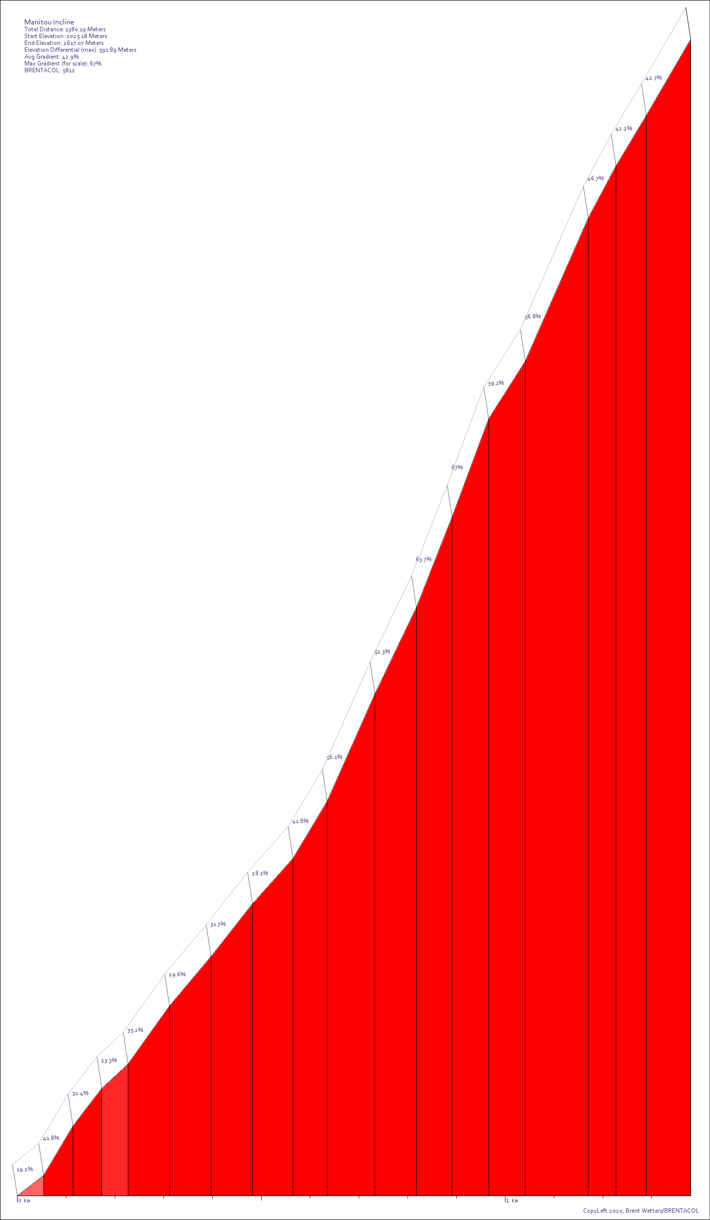
Manitou Incline is located in Colorado. It is 1380.2 meters long with an average gradient of 42.9% and a maximum gradient of 67%. Find similar hills.
View this hill in the BRENTACOL Toolkit!***This hill is hidden. It is retained in the database for the sake of curiosity. Either its elevation data is considered completely unreliable, or it cannot in any way be considered a "ridable" hill. It cannot be found by searches, but is accessible via a direct link.***
This hill is included just for fun. It is decidedly not rideable. If the gradient weren't bad enough, there are huge railroad ties running the whole way up, because this (like Mount Tom) used to be a cog train. The path that remains is considered to be one of the steepest walkable inclines on the planet, and certainly the steepest that ever had a railway installed. Runners like to test their times on this incline, even though, as yet, the path is technically not open to the public.