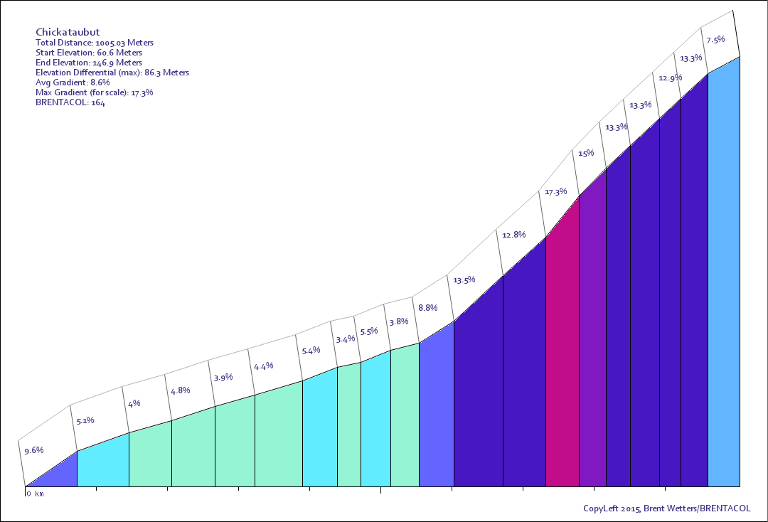
Chickataubut is located in Massachusetts. It is 1005 meters long with an average gradient of 8.6% and a maximum gradient of 17.3%. Find similar hills.
View this hill in the BRENTACOL Toolkit!Just a few miles from Blue Hill, this one really packs a punch at the top. The access road is a solid 10-15% the whole way up. The Audubon society has some sort of building at the top and they harass cyclists who use the road, and have recently put up "no vehicular traffic" signs. I climbed it and turned around just before the gate at the top to avoid any confrontation.